
Contents
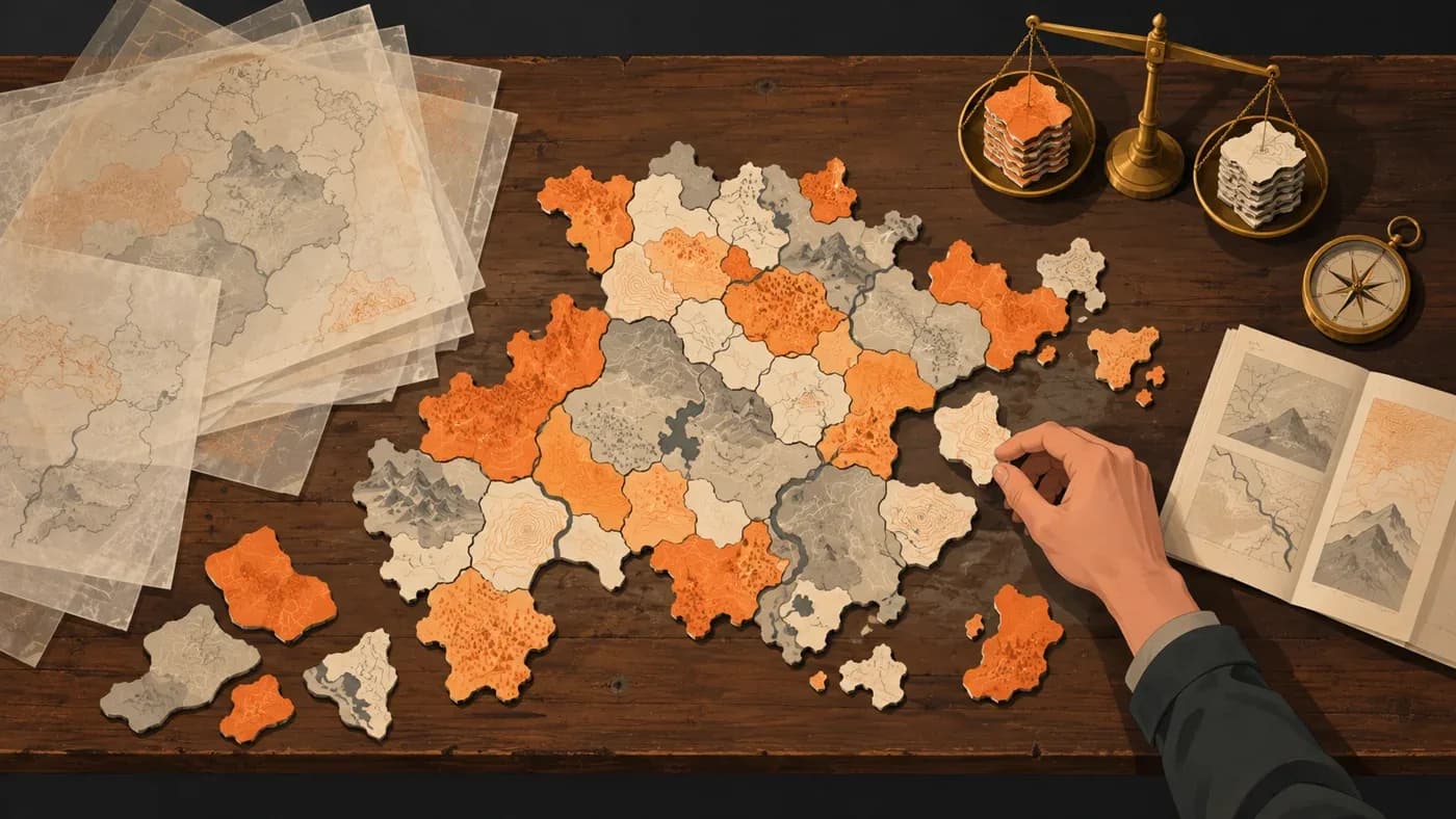
In short: MKA Engine's map tool combines historical boundaries, settlement points and terrain to create small selectable locations for strategy games. The map package measured for Mandates of History on 19 October 2026 contained 27,959 land locations and 5,733 water locations; these figures belong to that game's package, not to a fixed engine limit.
What was the problem?
A location on a strategy map is more than a colored shape on screen. Players select it, follow who controls it, move forces through it and compare it with nearby places. Its borders must therefore fit recognizable geography while remaining useful across regions of very different sizes.
Historical administrative borders are not enough on their own. In some places, source boundaries overlap; a city can sit close to a dividing line. Dividing the map into equal-sized pieces can ignore mountains and rivers, sending borders through natural obstacles. Following terrain alone can leave one region with tiny locations and another with very large ones.
Our goal was not simply to make as many small pieces as possible. We needed units that keep cities and passages understandable, respect the main shape of the land and remain manageable within a game's map package.
How did we solve it?
We combined historical and geographic layers
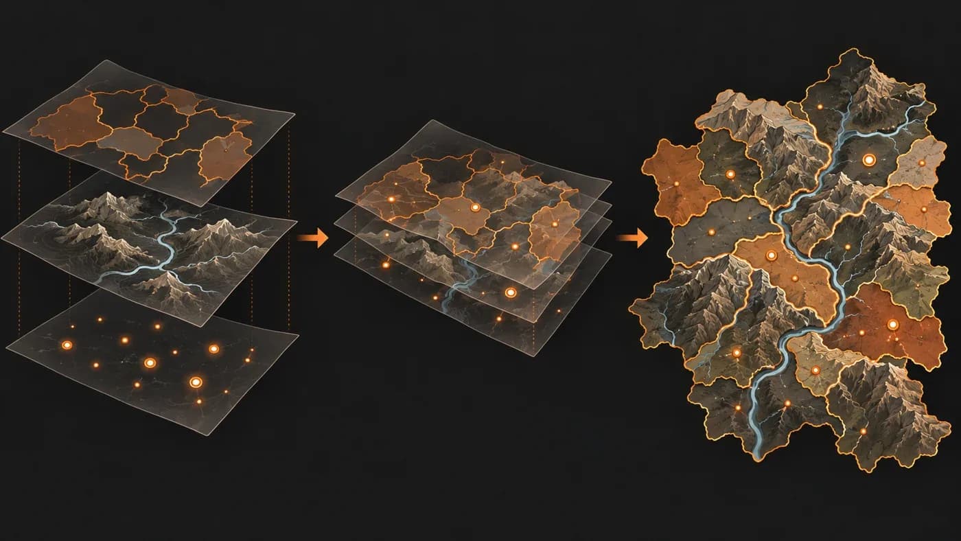
The map tool starts with historical boundaries and administrative units supplied by the game. Settlement points, rivers and elevation are considered alongside those outlines. The result comes from several kinds of evidence working together, rather than copying a single source map.
In the Mandates of History package, land is classified as settled, corridor or impassable, while water locations are counted separately. These are categories used by this game's map package. Another game does not have to use the same categories or counts.
We kept important centres while accounting for terrain
Cities and important passage points are fixed references that should not disappear from the map. We place those centres first, then distribute additional centres across the remaining space according to settlement density. Nearby land is assigned by considering how difficult it is to reach each centre across the terrain. Elevation and major rivers affect that calculation, so borders can follow valleys and mountain ranges more often than a perfectly straight grid would.
The first distribution is not the final one. Especially large settled areas can be divided when needed, and small disconnected fragments can be joined to neighbouring locations. The cities and passage points that we fixed are preserved during these adjustments. This balance does not make every location the same size: a broad, sparsely settled region does not need the same number of pieces as a densely populated one.
We connected locations into larger administrative groups
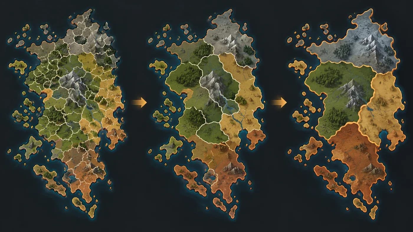
Small map locations are the lowest level that players interact with directly. Several locations can form a province, provinces can form larger areas, and areas can be grouped into regions. Here, a province means an administrative group that contains multiple small map locations.
To establish provinces, we first use historical administrative units. Where those are unavailable, historical city centres and present-day administrative boundaries act as supporting sources. This lets data from different periods contribute to one map, but it does not prove historical accuracy by itself.
The game's own content defines the names and extent of areas and regions. The map tool provides a way to use those groups; it does not invent them for every game. In this Mandates of History package there were 5,216 land provinces, 730 areas, 86 regions and 14 subcontinents. The median land province contained five locations; that does not mean every province contained five.
What did we observe?
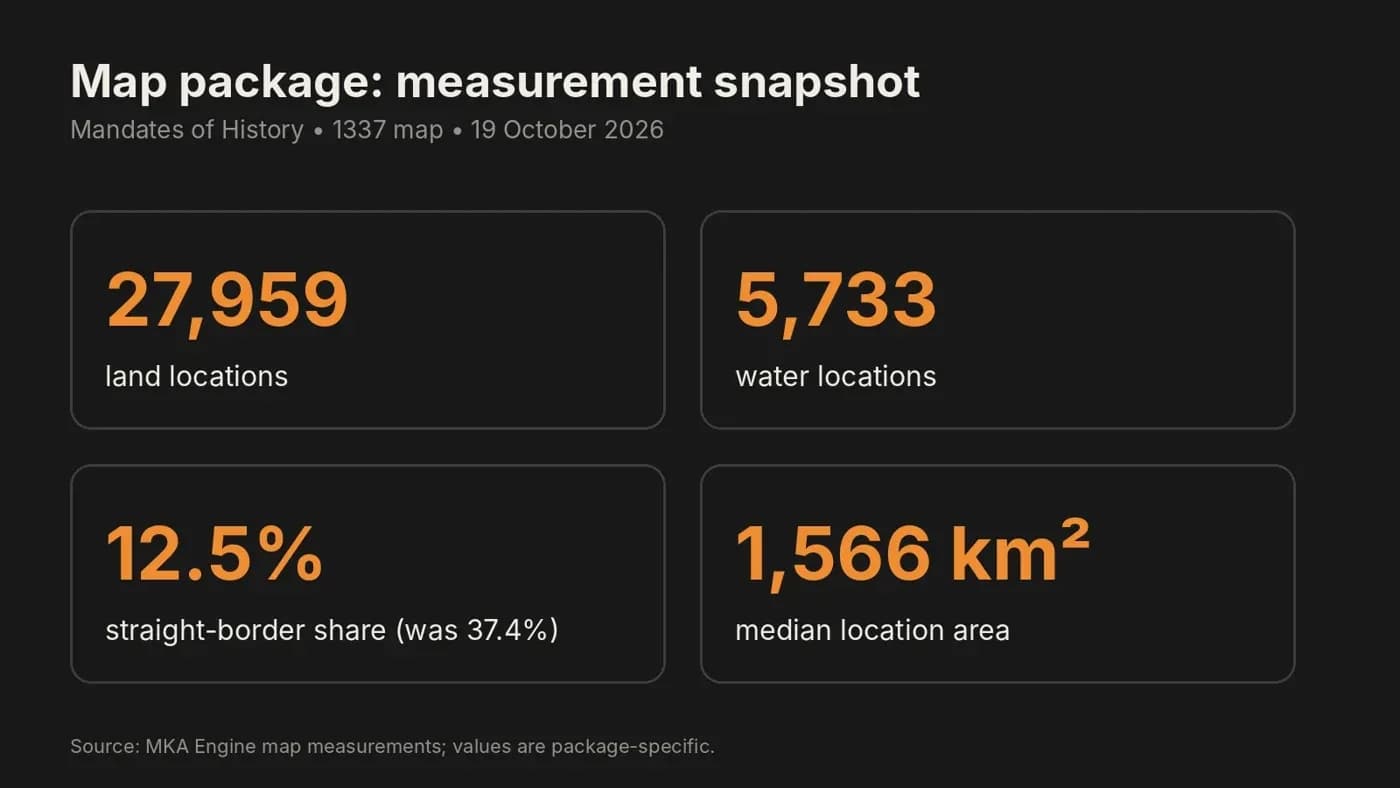
The figures below come from the package produced for Mandates of History's 1337 map on 19 October 2026. Of its land locations, 25,517 were settled, 136 were corridors and 2,306 were impassable, for a total of 27,959. The package also contained 5,733 water locations. These numbers describe a map made with that game's data and settings, not an unchanging MKA Engine capacity.
| Land-location category in this package | Count |
|---|---|
| Settled | 25,517 |
| Corridor | 136 |
| Impassable | 2,306 |
| Total land locations | 27,959 |
The median location area was 1,566 km². The median is the middle value when locations are ordered by area; it does not say that every location has this size. The map's detail and size distribution depend on the sources and settings chosen by the game.
The straight-border share measures how much of the boundary between land locations remains in long, straight stretches. It was 37.4% in an earlier package for the same 1337 map and 12.5% in this package. That change means fewer long, straight border stretches; it does not mean that historical borders were proven correct or that total border length fell by the same percentage.
The two latest package-generation runs, with the same data and settings, produced the same map package. That is an observation from those two runs, not an unconditional guarantee across every computer or version of the source data.
Why did we choose this approach?
Dividing the map only into equal pieces can separate cities from their historical context and send borders through mountains or rivers. Following terrain alone can leave a very uneven size distribution for play. We consider fixed centres, settlement density and the difficulty of crossing terrain together, then review oversized and disconnected pieces.
This approach aims to make the map feel more grounded while preserving the administrative groups used by the game. Still, rough source boundaries can remain rough in the result. For example, the measurement notes describe the 1444 South American base borders as coarse; the map tool does not turn that source into more precise historical evidence on its own.
The other half of the choice belongs to the game. The map tool processes settlement and terrain data; the game's own groups determine which areas belong to each region. That distinction allows the same mechanism to work with different historical sources and administrative structures in other games.
What does it cost?
The observed map-preparation run for this package took 24–33 minutes and used up to 9.2 GB of memory on the measured machine. Those figures describe a run on that machine under those conditions; they do not measure in-game speed or generalize to other machines and conditions.
The measurement covers the number of map locations, their area distribution and the shape of their borders. It does not evaluate historical accuracy or the quality of gameplay. Its meaning is limited by the sources used, so we present these figures as a snapshot of one Mandates of History package, not as a promise about every game or an engine-wide limit.
What comes next?
After looking at how map locations are built, we covered how player and country control differ: #15 — Switching countries and the observer role.
Frequently asked questions
What is a map location?
It is a small geographic unit that players can select as a separate place on the map. This package counts land and water locations separately.
Are 27,959 land locations a limit for every MKA Engine game?
No. This count belongs to the 1337 map package produced with Mandates of History's specific data and settings. Another game can choose a different count.
Do provinces, areas and regions automatically follow historical borders?
Province foundations use historical units and supporting city and administrative-boundary sources. The game's content defines the larger area and region groups; these counts are not a measure of historical accuracy.
Does a lower straight-border share mean a more historically accurate map?
No. The measure describes the share of long, straight border stretches. It does not evaluate the accuracy of historical sources.
Links
Sources and related docs
You may also like
- How is a strategy game's world map made?
For MKA Engine we built a 27,357-location world map of 1337 from real data: how terrain, rivers, straits, population and location borders were made.
- The road to a game engine
How we started MKA Engine: reading four games, treating determinism as law, moving phase by phase with measurements, and where we are now.